


Voting District 58, Muskogee County, Oklahoma
About
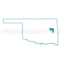
Outline

Summary
| Unique Area Identifier | 654507 |
| Name | Voting District 58 |
| County | Muskogee County |
| State | Oklahoma |
| Area (square miles) | 77.77 |
| Land Area (square miles) | 73.14 |
| Water Area (square miles) | 4.63 |
| % of Land Area | 94.04 |
| % of Water Area | 5.96 |
| Latitude of the Internal Point | 35.48844420 |
| Longtitude of the Internal Point | -95.15148580 |
Maps


Graphs
Select a template below for downloading or customizing gragh for Voting District 58, Muskogee County, Oklahoma


Neighbors
Neighoring Voting District (by Name) Neighboring Voting District on the Map
- Voting District 203, Sequoyah County, OK
- Voting District 210, Sequoyah County, OK
- Voting District 211, Sequoyah County, OK
- Voting District 212, Sequoyah County, OK
- Voting District 28, Haskell County, OK
- Voting District 44, Muskogee County, OK
- Voting District 60, Muskogee County, OK
- Voting District 64, Muskogee County, OK
Top 10 Neighboring County Subdivision (by Population) Neighboring County Subdivision on the Map
- Muskogee CCD, Muskogee County, OK (55,694)
- Vian CCD, Sequoyah County, OK (8,077)
- Stigler CCD, Haskell County, OK (4,293)
- Porum CCD, Muskogee County, OK (2,652)
- Webbers Falls CCD, Muskogee County, OK (1,519)
Top 10 Neighboring Place (by Population) Neighboring Place on the Map
Top 10 Neighboring Unified School District (by Population) Neighboring Unified School District on the Map
- Stigler Public Schools, OK (6,628)
- Vian Public Schools, OK (4,716)
- Gore Public Schools, OK (3,136)
- Porum Public Schools, OK (2,375)
- Webbers Falls Public Schools, OK (1,823)
- Braggs Public Schools, OK (1,055)
Top 10 Neighboring State Legislative District Lower Chamber (by Population) Neighboring State Legislative District Lower Chamber on the Map
Top 10 Neighboring State Legislative District Upper Chamber (by Population) Neighboring State Legislative District Upper Chamber on the Map
- State Senate District 3, OK (80,333)
- State Senate District 9, OK (75,370)
- State Senate District 7, OK (73,650)
Top 10 Neighboring 111th Congressional District (by Population) Neighboring 111th Congressional District on the Map
Top 10 Neighboring Census Tract (by Population) Neighboring Census Tract on the Map
- Census Tract 14, Muskogee County, OK (7,207)
- Census Tract 15, Muskogee County, OK (6,699)
- Census Tract 302.02, Sequoyah County, OK (5,509)
- Census Tract 2792, Haskell County, OK (4,293)
- Census Tract 302.01, Sequoyah County, OK (2,568)
Top 10 Neighboring 5-Digit ZIP Code Tabulation Area (by Population) Neighboring 5-Digit ZIP Code Tabulation Area on the Map
- 74403, OK (30,709)
- 74462, OK (7,875)
- 74962, OK (5,092)
- 74435, OK (3,185)
- 74455, OK (3,158)
- 74470, OK (1,693)
- 74423, OK (872)